I get off work at 4:00 on Fridays, filled the car up with gas, went home and unloaded all the horse-related junk from my car (two saddles!) and loaded it up with our suitcases we'd already packed. We set food and water out for the cats, and were out of the house by a little after 5:00. I asked Nathan how hungry he was--we could eat dinner in Bend, Sisters, Salem, etc... He was hungry NOW, so we ate at one of our usual haunts in Bend, so didn't really hit the road until after 6, but that was okay--it's just a three-hour drive, so we'd still have mostly daylight to drive in and get there in plenty of time for bedtime. :-)
The drive was fine--it rained from the pass onward, including some heavy squalls. But we were in no hurry, so it was fine. I'd been threatening Nathan leading up to the trip and during the drive that we'd be staying at McMenamins (yes, in McMinnville!) again--they're a northwest "chain" that buys up historic old properties and remodels them into hotels, restaurants, bars, theaters, spas, etc., often multiples of these types of businesses within one property. When we stayed at McMenamins at my graduation, I skimped on the room fee by getting a "European-style" room, with the bathroom down the hall. I think Nathan and I had to share a queen bed, too, but I don't recall. He was NOT impressed--ambiance is not enough to overcome the funky smell, lack of bathroom in the room, and lack of a pool at the hotel for a kid. :-) So this time I'd booked a motel with a pool, but joked with Nathan that we'd be staying at McMenamins again. So I think he was pleased when we pulled into a chain-looking motel instead. :-)
We checked in, settled into our room, and just played around on our respective phones/computers until we were ready for lights out.
In the morning, we showered and got dressed, then went to the lobby area to partake of the "free" breakfast. There was someone ahead of us who had a bunch of kids, so it took him a while to make his family's waffles, but then Nathan and I each made a waffle and settled in for breakfast. They had real butter, but the syrup left a lot to be desired, as did the rest of the selection, so we decided that the next day, we'd splurge on a restaurant instead.
We went back to the room to gather what we'd need for the day's planned outings, and we were still running a little early (museum didn't open until 9:00), so I asked Nathan whether he'd rather hang out in the room to kill time or head out and do some geocaching before they opened. He opted for the latter. So we parked in the still-empty parking lot (though there was a Boy Scout Campout going on on the museum grounds, so there were tents pitched in the grass and people hollering on a PA system) and started wandering. We passed the planes they had parked outside the museum on our way to the first geocache.


In this shot, the building on our right is the air museum (it houses the Spruce Goose), and straight ahead, with a 747 on top of it, is the building that houses the water park. There are waterslides coming out the sides of the 747, much as an emergency escape slide would, except that they're fully enclosed. :-)

It took way longer than it should have (3-4 minutes) to find a geocache of this type, but I'd been looking at the wrong structure at first. (Phone isn't nearly as accurate as a real GPS unit, so when I finally zoomed in the satellite image map, I saw that the compass arrow was pointing me a few feet off.) We also hadn't brought a pen with us--it was back in the hotel room, so I took a photo to prove to the cache owner we were there since we couldn't sign the log. Technically, they can remove our electronic log since we didn't sign the paper one, but hopefully they don't.

There was another cache nearby and we still had time to kill, so we set off down the path between a vineyard and a small forest. Pretty walk early in the morning, but I'd worn sandals, so my toes were numb after walking through the wet grass!

We found that cache TOO easily (I'd seen a hint in the cache description that let me know what it was when I saw it, though it was well camouflaged). It had a pen inside the cache, so we were able to sign it. :-) We kept wandering around the vineyard back toward the museum. There was another cache right next to the museum, but it said you needed caching tools (could mean a knife, tweezers, magnet, tool for prying...you never know, but we had NO tools, not even a pen). We headed that direction, figuring we'd at least see whether we could access it, but it ended up being time to just head into the museum by the time we got that far, so we didn't even try to find it.
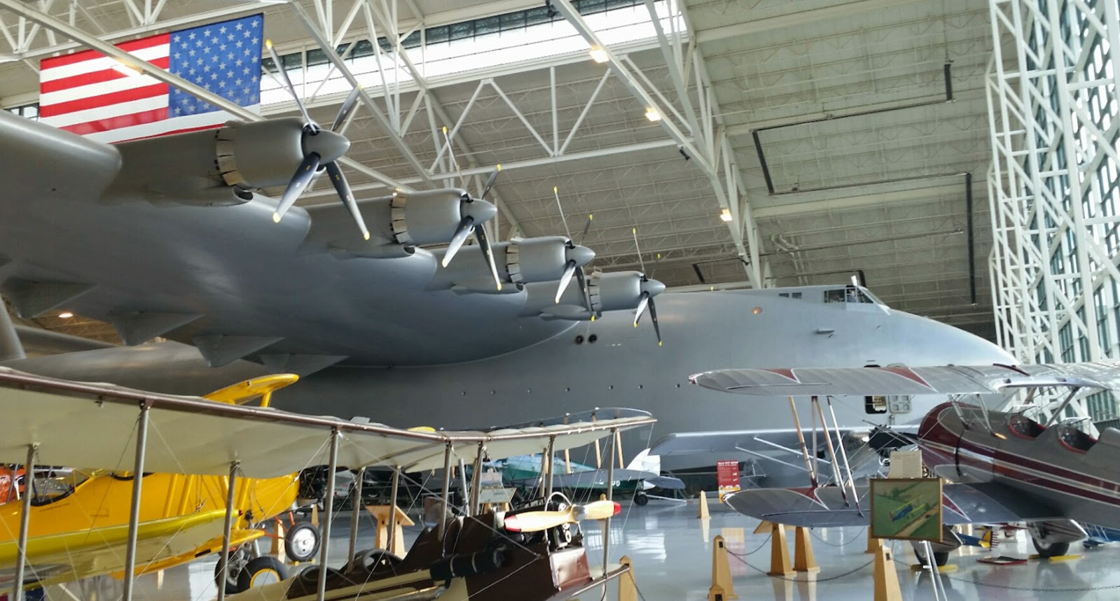
I think the biggest feature of this museum is the Spruce Goose, which overwhelms the building. Here's a picture of just part of one wing--that's all that would fit into the picture from that angle!

This plane had a very polished propeller and nose cone, and I was trying to surreptitiously take a photo that included Nathan, but he realized that and hid behind me. Oh well. Selfie it is, then.

Ha! Got him in this one! He's the skinny black and blue blob toward the right.

Another view of the Spruce Goose, from the very corner of the "hangar."
Had to take a photo of this very graphical view.

The plane on the top left looks EXACTLY like one my dad had part ownership of when I was a kid. V-tail Bonanza, and even the paint job is very similar, if not the same. Doubt it's the exact same plane, though...

Rear view of the Spruce Goose.

After we finished in the "air" side of the museum, we headed over to the "space" building. There's also a building that houses a theater, but Nathan wasn't interested in seeing any of the films they were showing, so even though the movie price was included with the admission, we never went into that building.
The base of this rocket was actually 2+ stories down below. I tried taking a panorama shot of the whole thing, but either the top would be overexposed or the bottom would be underexposed, so oh well. You could walk down a stairway to the next level down, where they had a simulated control room with audio from the 3 minutes preceding through the minute or two after the launch. When the rocket on the video screens launched, the building actually shook, which surprised me!

Then another level down, you could check out the valves and such. I was surprised they let you get so close. And of course I'm not sure if it's a real one or a replica, and how true-to-life all that stuff is, but whatever.

Replica space suit, with a memorial to Neil Armstrong at its feet. Again, there should be a reflection of Nathan and me in the visor.

At the far end of the "space" museum, they had a bunch of non-space related stuff (maybe there wasn't any more room in the air museum?), with a section dedicated to helicopters. We wandered through, commenting here and there, then spotted this contraption:

Sorry for only being able to take a photo toward the window, but it's got basically a minimalistic chair seat, no seat belt or arms or anything to really hold you in other than gravity, a couple rudder pedals, all of three gauges, a rotor above, and an engine behind. Apparently it's not actually a helicopter, but an auto-gyro. The top rotor isn't powered, and only generates lift when there's air flowing upward, causing the rotors to spin, and THEN they generate lift. There's a propeller behind the pilot that IS powered, and generates forward motion. I have NO idea how the thing translates forward motion into enough air flowing upward through the rotors to generate lift--seems like it'd work better as a glider after being dropped off/out of someplace high than able to lift off a runway, but whatever. The sign didn't explain how it accomplished lift at ALL. Huh.
Then there was this contraption:

In case the seat on the earlier one wasn't minimalist enough for you, this was basically a wide bicycle seat, though at least this one did have safety harnesses. It was basically a tripod with an engine, seat, and rotor. It could be collapsed into a small pod, and dropped to stranded soldiers who could fly it out to safety. This one WAS a powered helicopter, so while it didn't look safe, I could at least understand HOW it could fly.
And finally, one more interesting single-person helicopter-like craft:

You stand, like on a Segway, and it even had similar handlebars. The rotors are just below the pilot's feet, and it's intended to float on water. Eh, no thanks. I'll swim. Another view:

And of course it's always cool to see the SR-71 Blackbird up close and personal. I didn't touch it, but totally could have. The air portion of the museum had stanchions and ropes around most of the aircraft, preventing you from getting too close. The space side had some, and in fact you can see them in this photo, but not nearly as close to the aircraft as the other building, and in fact, there was a large area in which you could just totally roam around amidst the aircraft, bonking your head on things left and right if you were so inclined. They had ribbons on some of the lower-hanging things, but yeah, basically unprotected from harming or being harmed by humans.


A drone:


After the air & space museums, we drove a few hundred yards to the nearby water park building. Boy, that place is NOT cheap. I sprung for a locker so I could lock up my credit card and phone. So now I had THREE green wristbands--the one on the right was from the air & space museum--since it's in separate buildings, they give you a wristband when you've paid so you can come and go from any of them. I kept it on in case Nathan wanted to go back after the water park. The one on the left was for admission to the water park. The one in the middle was for access to the locker--how cool is that? Instead of a physical key (and instead of only being able to access it once per each quarter you have to insert or whatever), there was a chip inside the wristband that gave you access to your locker. Also, the lockers were in a communal lobby area, so family members of any gender could access the same one (though unless they give out multiple wristbands per locker, they'd need the right family member with them), THEN you go into the segregated restrooms / changing rooms (or one of the family ones off the main locker area), then meet back up at the locker to stow your stuff. Seems like a good system for a place like that, where multiple people would want to share lockers and access them throughout the day. But yeah, three wristbands was a little weird.

I didn't take any photos at the water park, but it's about what you'd expect. It had a wave pool (that alternated between being a wave pool, a non-wave pool, and a non-wave pool with fountains in the middle of it), a kiddie play area that included small slides and a bucket (made to look like a fire-fighting bucket under a helicopter) that dumped a big load of water periodically. There was also a shallow-ish pool with a whirlpool area that actually got spinning fairly fast, and a hot tub. But of course the main feature is the water slides. There were four water slides--one you use without a tube, and three you use with one- or two-person tubes. Nathan didn't want to share tubes, so we always went in single tubes. The first slide we did turned out to be the "scariest" one, in retrospect. It was totally dark and had a few drops early on, then opened up to be lighter and even open at the end. Then Nathan tried the one without a tube, but I did what turned out to be the tamest slide (with a tube), then our next trip to the top, there was starting to be a bit of a line. I waited quite a while to ride the last tube-required slide I hadn't tried yet. I liked that one the best--it also had a dark tube with a drop or two at the top, but it quickly opened up into a "toilet" bowl--about what it sounds like--you're spit out at the top of a bowl-shaped feature with enough momentum to go around and around a few times. As you slow, you head down toward the bottom, where eventually you're spit out down the "drain"--a last little ride down to the exit area.
Nathan rode the slides a few more times, but I was tired of climbing stairs and waiting in line. So I sat in the hot tub, "rode" in the whirlpool, and played in the wave pool a bit. Nathan would join me occasionally, then head off for another water slide or two. We were both getting hungry, and debated between eating at the cafe there (not a great selection, not cheap, but obviously easy to eat there and get back to swimming) or leaving and getting food elsewhere (and THEN the debate would be whether to come back or not). Nathan decided he'd play a little more, then be done for the day and we'd eat elsewhere.
After we both changed back into our clothes, we headed downtown, found a parking spot, and wandered around. I told Nathan to both choose a lunch spot AND keep an eye out for what he'd want for his "birthday" dinner (his birthday wasn't until the next day, but we'd be driving back mid-day to get him back to his dad's house for birthday dinner with them). We walked down the main street, and about halfway back up it, and what Nathan wanted was to eat at McMenamins. I pointed out that we could eat from the same menu whenever we wanted in Bend, but that's what he wanted, so that's what we did. We stuffed ourselves silly.
After that, we wandered back toward the car, with a stop for Nathan's birthday "cake"--specialty chocolates. We each chose a few pieces to save for after dinner.
The only other thing I'd noted to do in the area (that was family-friendly--there's a LOT of wine tasting in the region!) was a glass blowing shop just out of town. I'd figured the museum and water park would keep us busy on Saturday and we'd have to save the glass shop until Sunday, but asked Nathan if he wanted to check it out that afternoon, and he agreed, so that's what we did. The artisan was very friendly, explaining what he was doing. He stopped for a bit, apparently because he thought he was boring us, but when I asked if he was done for the day or had stopped on our account, he started taking requests. :-) It was really interesting to watch, especially with his narration on what he was doing and why, and how he was affecting the glass by what he was doing (color, shape, etc.). I bought a necklace (after I bought it, he said it was actually something a different artisan had made--oops!) kind of as "payment" for taking up his time, but I like it and will wear it pretty often, I think (I'm wearing it now), so it's all good.
We headed back to the hotel after that, and just sat around a while. Nathan was craving sushi for dinner, and we hadn't seen a sushi place downtown, so with the help of Yelp and Google Maps, we discovered there is ONE place in McMinnville, in a strip mall area. When we both got hungry enough, we headed there, skeptical. It had mostly good reviews, with a couple people saying it wasn't fresh. But it looked fine and seemed to have some vegetarian selections (for me), so we took a seat. It's the kind of place with a conveyor belt, so that was a new experience (for me--Nathan had been to a similar place in Bend a bunch of times). I had to ask the hostess/waitress what was inside a couple of items, but they both turned out to be vegetarian--yay! Nathan tried sashimi for the first time--he wasn't a fan, but finished both pieces. But he mostly stuck to rolls with raw fish, or sashimi-style pieces with cooked fish on top of the rice. They had some dessert items, too, so we stuffed ourselves pretty full, then knowing it was a pretty early dinner and sushi doesn't stick with you long, we also went to the Albertsons next door for some snacks and drinks for later that night (if we needed them) and for the drive the next day.
We went back to our hotel room. Nathan checked out the hotel pool, but deemed it not worth it (especially after spent so much time at the water park earlier the same day!), so we hung out in the room, played cards, watched TV, and played on our electronic devices.
The next morning (Nathan's actual birthday!), we slept in without any alarm, packed up, and checked out. We checked out the breakfast options on Yelp again. Nathan wanted IHOP (what IS it with this kid and chain restaurants?), but the nearest one was a long way away and not on the route I was planning to take, so we chose one of the top-rated places back downtown. We arrived at a good time--just had to wait behind one other couple for a few minutes, but there was quite a line stacked up when we left. The menu was limited, but we both found something delicious to eat, then hit the road for real.
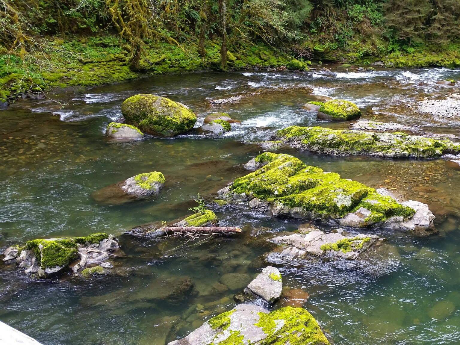
I chose a different (slightly longer) route home, to enjoy the view. I think I've only driven this road one other trip, a long time ago, and I remembered it was beautiful. It didn't disappoint. Usually, I drive as fast as conditions allow and end up getting frustrated when someone in front of me is going slower than I would like. But I was perfectly content to go for a Sunday drive (which it was!) and wind my way down the road slowly, soaking in the views. There was so much moss it reminded me of the rainforests on the Olympic peninsula. I asked Nathan if he wanted to actually stop and go for a hike (or geocaching, except I didn't get cell service in the area and hadn't pre-downloaded any caches to use offline), but he didn't want to. So we just made one stop, at a spot I'm pretty sure I'd stopped at on the last trip, when he was just a little toddler. Such pretty views!


We got home around 2-ish, unpacked, and his step-mom picked him up for their dinner with him. I think it was a pretty nice birthday weekend trip for a 13/14-year-old, and hopefully Nathan agrees.


